
Environmental Drone Surveys Ireland
Environmental Drone Surveys Ireland | High-Resolution Habitat & Forestry Mapping
In the rapidly changing Irish landscape, traditional ground-based environmental monitoring is no longer enough. At DataDrone, we provide high-precision environmental drone surveys that deliver centimeter data for ecological consultants, local authorities, and forestry managers. By combining the power of the DJI M300 RTK with the 61MP Sony A7RIV, LiDAR integration and multispectral imaging we capture the natural world in more comprehensive detail, allowing for more accurate habitat assessments and environmental impact reports.
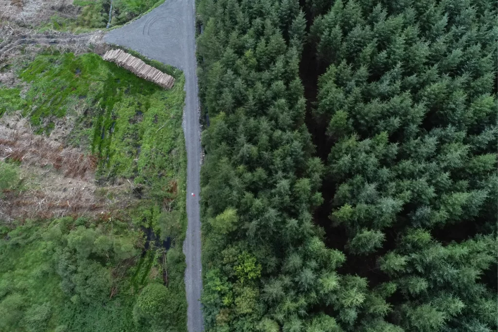
Precision Forestry: Tree Counts & Canopy Analysis
Managing Irish forestry assets requires accurate, up-to-date data. Our drone workflows replace manual estimations with verified geospatial datasets. We specialize in:
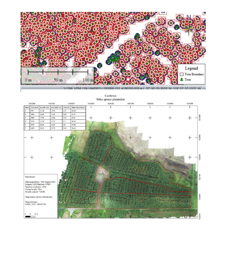
Automated Tree Counting: Using drone processed data (DEM/CHM) to provide accurate stocking reports.
Canopy Height Models (CHM): Generating precise digital surface models to monitor growth rates and timber volume.
Health & Stress Analysis: Utilizing multispectral sensors (deployed via our M210 platform) to identify early signs of disease, nutrient deficiency, or drought stress before they are visible to the naked eye. Spectral analysis can also allow for species delineation, allowing for deeper analyses.
Windblow & Storm Damage Assessment: Rapidly mapping forest blocks after extreme weather to quantify loss for insurance and replanting strategies.
Coastal Erosion & Marine Mapping
With Ireland’s coastline facing increasing pressure from climate change, our coastal drone mapping services provide a vital “baseline” for monitoring. We generate high-density point clouds and orthomosaics to track:
Soft Cliff & Dune Erosion: Measuring volumetric loss of sand and soil over time.
Intertidal Mapping: Capturing high-resolution data during low tide for marine biology and habitat studies.
Sea Wall & Infrastructure Integrity: Inspecting hard coastal defenses for structural shifts or damage.
We can provide GIS platforms for clients to swipe through periodic orthomosaics to visually inspect changes as well as developing web mapping solutions for users to easily access and share the same data.
Habitat Mapping & Invasive Species Detection
Our high-resolution data collection follows the best practices set out for Environmental Drone Surveys Ireland, ensuring that our outputs meet the rigorous standards required by the Irish EPA and other regulatory bodies for Natura 2000 site monitoring.
Invasive Species Identification: Our 61MP sensor allows ecologists to identify species like Rhododendron ponticum or Japanese Knotweed across vast, inaccessible terrain.
Wetland & Peatland Monitoring: High-resolution orthomosaics and multispectral index maps help track water levels and vegetation health in sensitive bog ecosystems.
Environmental Impact Assessments (EIA): Providing the baseline geospatial data needed for planning applications and conservation projects.
The Technology Behind the Data
Our environmental outputs are only as good as the hardware that captures them. We utilize the DJI M300 RTK paired with the Sony A7RIV to ensure every pixel represents real-world information. We use LiDAR for fast and efficient data processing and delivery. For specialized vegetation health mapping, we deploy multispectral imaging to capture the “invisible” data required for professional ecological reporting.
Explore our full suite of surveying hardware on our Technology Page
High-Precision Deliverables for Environmental Reports
When commissioning Environmental Drone Surveys Ireland, the quality of the data is paramount for legal compliance and scientific accuracy. We provide a suite of deliverables tailored for environmental impact assessments (EIA) and conservation monitoring:
Ultra-High Resolution Orthomosaics: With a Ground Sample Distance (GSD) of under 1cm possible, these maps allow for individual plant species identification.
3D Digital Surface Models (DSM): Essential for calculating the volumetric loss in coastal erosion studies or peatland restoration projects. In forestry, Canopy Height Models allow for automated tree height and count inventory (surface model minus ground model creates a CHM)
Contour & Topographic Mapping: Critical for flood risk assessment and hydrological modeling in sensitive wetland habitats.
NDVI & Multispectral Indices: Specialized data for analyzing vegetation health and identifying drought stress in forestry assets. Species delineation for deeper and more accurate forestry surveys
Geo-Tagged High-Resolution Imagery: Individual 61MP captures for visual inspection of sea walls, cliff faces, and canopy structures.