Drone Construction Progress Ireland - As-Built & CAD
Drone Construction Progress Ireland: At DataDrone, we provide project stakeholders with a high-resolution, georeferenced visual record of site development. In an industry where digitalization is rapidly streamlining civil engineering, our Drone Construction Monitoring ensures that your project has a precise, “Time-Stamped” record from break-ground to final handover.
We specialize in high-accuracy data acquisition designed with your specific engineering requirements in mind. Using mechanical shutter DJI cameras and Sony 61MP sensors and LiDAR technology, we capture the site in its true state, providing the foundational data that allows engineering teams to verify as-built conditions and reduce project risk.
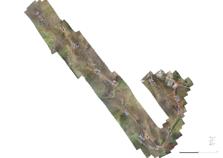
Orthomosaic used to digitise and extract features on a completed wind farm project to verify build was to design
Drone Linear Surveying Ireland – Infrastructure & Road Tracking
Large-scale infrastructure projects require a higher level of data consistency than standard aerial photography can provide. Specializing in Drone Linear Surveying Ireland-wide, we provide the continuous, high-overlap imagery required for corridor mapping and monitoring.
For recurring projects, we conduct periodic surveys to document every stage of the build and provide web mapping formats for each of viewing and sharing. By capturing hundreds or thousands of high-resolution images per visit, we generate a seamless, georeferenced dataset. This allows site managers to track sub-base preparation and earthworks progress while maintaining an undeniable visual audit trail to verify subcontractor claims and site logistics.
Engineering-Ready Data: Point Clouds & CAD Integration
We specialize in transforming aerial captures into actionable engineering assets. By delivering dense LiDAR and photogrammetric point clouds and orthomosaics, we provide the ground truth needed for professional As-Built Documentation Ireland-wide.
Our data is optimized for seamless integration into industry-standard software. We can digitise features in CAD while recognising that the final linework is often best handled by the project engineers who hold the design responsibility. We can offer however,provision of survey-grade outputs compatible through platforms like Virtual Surveyor for manual or semi-automated feature extraction.
By providing georeferenced Orthomosaics and Digital Terrain Models (DTM), we empower your in-house team to digitize vector features, extract drainage runs, or generate planimetric drawings directly within their own CAD environment.
Professional CAD Drawings Ireland – Planimetric Accuracy
Our CAD Drawings Ireland service utilizes high-resolution aerial data to accelerate the drafting process. We provide the precise data that allows for the rapid generation of SHP or DXF files without the need for traditional, time-consuming ground-based measurements.
Using the orthomosaic as a highly accurate base layer, features such as curb lines, manholes, and structural footprints can be digitized with centimeter-level confidence. This facilitates the automation or manual planimetric drawing process, allowing your engineering team to move straight into the design and verification phase.
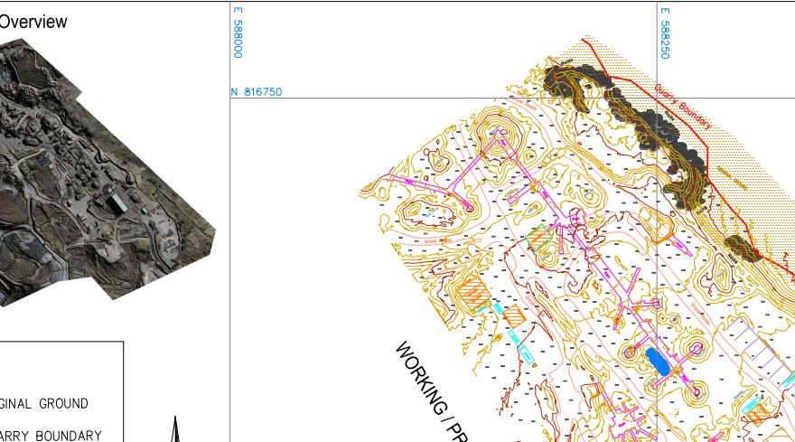
sample CAD drawings completed based on present features as revealed by drone survey and orthomosaic output
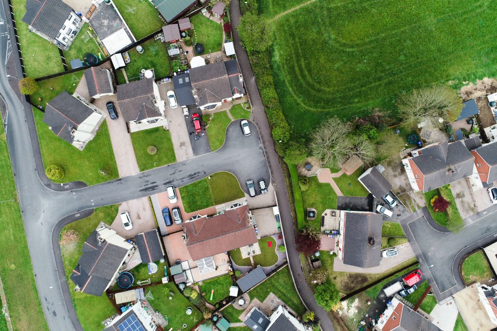
Very high resolution (VHR) drone image
Drone Boundary Survey Ireland – Legal & Land Registry
Our documentation services extend to legal and planning requirements through professional Drone Boundary Survey Ireland-wide. We utilize high-resolution orthomosaics to map existing physical features—fences, walls, and historical markers—with a level of detail ground-based photography cannot match.
By overlaying Ordnance Survey (OS) maps onto this imagery, we help identify discrepancies between registered folios and the reality on the ground. This ground truth perspective is essential for land subdivision, planning applications, and providing the visual evidence required for resolving complex boundary disputes.
7 Key Advantages of our Construction Documentation
Centimeter-Level Accuracy: Survey-grade data using DJI mechanical shutter camera drones and enterprise drones and equipment (M300 RTK, 61MP Sony camera, LiDAR)
Recurring Site Audits: Consistent monthly linear tracking.
Engineering Integration: DWG/DXF for CAD integration
Risk Mitigation: Unbiased visual records for dispute resolution.
Legal Verification: Precise Drone Boundary Surveying for Land Registry.
Rapid Turnaround: Provision of CAD vectorised drawings, semi-automated linework and CAD-ready /DWGDXF files delivered faster than ground surveys.
Safety Compliance: Fully insured and AirNav Ireland coordinated.
Safety & Compliance
Operating a drone on an active construction site requires full compliance with IAA regulation and EASA standards as well as coordination with Airnav Ireland.
We manage all necessary flight permissions and coordination with the IAA, ensuring that our Drone Construction Progress monitoring is collected without interrupting site operations or compromising safety. With comprehensive public liability insurance and a focus on risk assessment, we provide the high-quality data you need with the professional oversight your project demands.