Topographical surveying involves accurately representing the natural and built world in a digital environment. At DataDrone, we specialize in delivering centimeter-level accurate deliverables for site planning and infrastructure projects through our Drone Topographical Survey Ireland services.
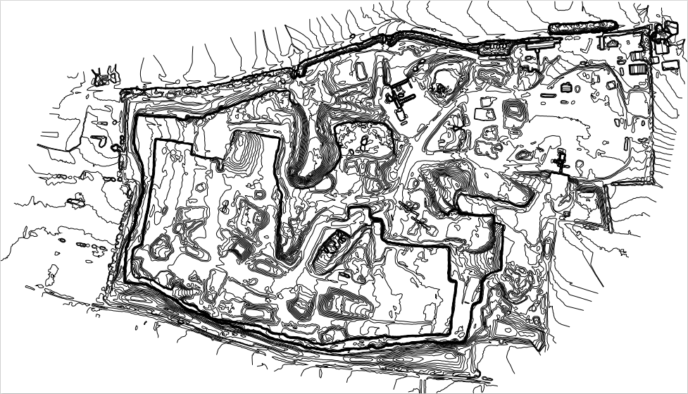
Contour lines are generated to indicate precise levels across the site, providing a clear visual representation of vertical relief. For engineering workflows, a dxf file can also utilized to import these elevations directly into CAD software. By using Topographical Mapping techniques to capture millions of data points per site, we ensure that every feature is accounted for in the final dataset.
Generated contour lines (quarry)
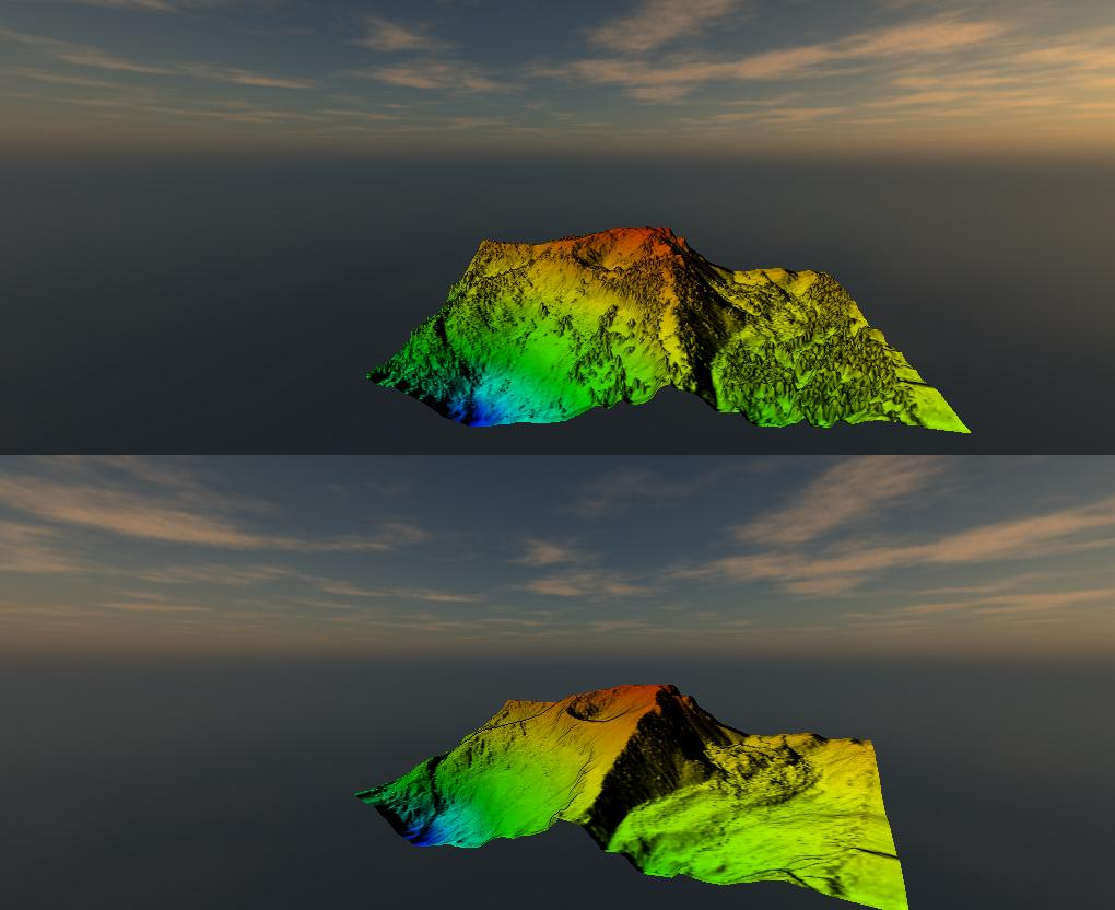
DSM representing the terrain and vegetation on it; DTM representing terrain only. Datasets processed from aerial LiDAR data from OpenTopography
Terrain Modeling (DSM vs. DTM)
Drone Land Survey Ireland – accuracy of data requires understanding of surface modeling. Digital Surface Models (DSMs) represent and map the Earth’s surface and every feature on it, including structures and stockpiles. In contrast, Digital Terrain Models (DTMs) map the bare ground surface (terrain) only.
These models are created by interpolation of a Triangulated Irregular Network (TIN) or a raster-gridded DEM, depending on the project application. A terrain model created from photogrammetry can be further refined by removing obstructions from the point cloud—such as trees or construction rubble. In these scenarios, elevation values are interpolated around the perimeter of the obstruction to maintain a clean, usable surface for earthworks calculations. Re: the latter, learn more on our Drone Stockpile Measurement Page
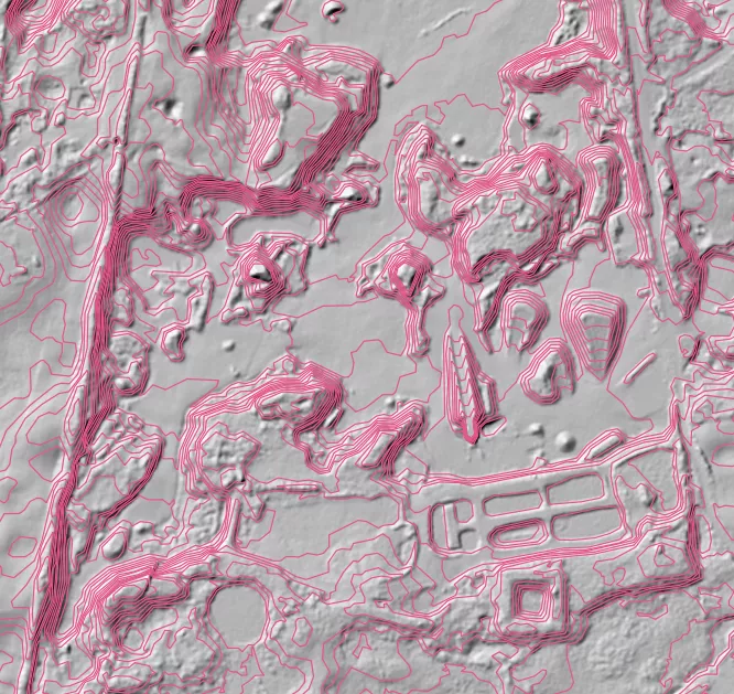
LiDAR Topographical Mapping Ireland for Dense Vegetation
While we use photogrammetry-based methods where applicable (primarily on hard surfaces), limitations exist regarding vegetation. Our investment into LiDAR technology solves this problem; laser pulses penetrate dense vegetation to reach the ground level and create a rasterised surface from densely collected vector points on the ground, ensuring reliable Aerial Site Surveys Ireland regardless of surface cover.
A LiDAR-derived point cloud allows for the rapid processing of DEMs and contour line generation, even in “leaf-on” conditions. By utilizing a dual-sensor payload (RGB camera and LiDAR), the resulting point cloud is colorized with realistic RGB values. This dual-stream data collection allows for the generation of high-resolution orthomosaics alongside the survey-grade LiDAR data, providing a comprehensive Digital Twin Ireland-ready dataset.
Our operations are conducted in strict accordance with AirNav Ireland safety standards and EASA regulations, ensuring fully compliant aerial data collection for every project.
Our high-precision Drone Topographical Mapping Ireland services are tailored to meet the rigorous demands of various industries. By providing a Digital Twin Ireland-ready dataset, we enable stakeholders to make data-driven decisions from the planning stage through to completion.
Residential & Commercial Development
For greenfield and brownfield sites, an Aerial Site Surveys Ireland project provides the foundational data for architects. Our Drone Land Survey Ireland outputs allow for precise boundary verification, existing structure mapping, and drainage slope analysis, significantly reducing the risk of design errors during the initial planning phase.
Infrastructure & Road Networks
Linear projects, such as road infrastructure survey, benefit from the speed of drone data collection. We provide high-resolution contours and DTMs that integrate directly into existing workflows, allowing for accurate cut-and-fill volumetric analysis and progress monitoring.
Quarry & Environmental Management
n hazardous environments like quarries, our LiDAR technology provides a safe alternative to ground-based surveying. We can capture baseline surveys even during active topsoil removal, providing the Topographical Mapping required for regulatory compliance and environmental impact assessments without interrupting site operations.
By choosing DataDrone for your Drone Topographical Survey Ireland, you are investing in a workflow that prioritizes safety, speed, and engineering-grade accuracy.