Digitalisation is rapidly streamlining construction and civil engineering. New ways of capturing and utilising data are making construction safer and more efficient. We can provide a competitive edge to your business through documentation that is not only visual, but also created with your accuracy requirements in mind.
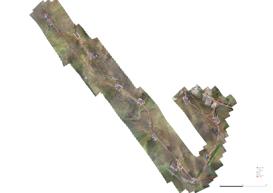
We can use point clouds from our photogrammetric and LiDAR data and orthomosaics from our photogrammetric data to digitise vector features and export this data as shp/dxf files for clients to use for planning purposes in CAD software. We can also use tools to facilitate the automation of these as built/planimetric drawings.
Orthomosaic used to digitise and extract features on a completed wind farm project to verify build was to design